Click here to add text.
FACT PAGE
Facts, Figures, Schedules:
1. Chappy Path Committee says: From 1988-2005 there were 8 injurous bike accidents on Chappy, none involving a collision with a Motor vehicle. During this time there were 35 motor vehicle accidents on Chappy.
2. Roger Becker reports the Edgartown Police told him on 12-17-08 that there were 311 Bicycle Accidents in Edgartown between 1992 and 2008, not including 2002 from which year records were lost. 132 of these involved Motor Vehicles. There were a total of 3700 Motor Vehicle accidents in Edgartown over these years.
3. K. Rose, secretary to the Community Preservation Committee reports the committee recommended the $27,842 for a survey as proposed to the Town Meeting (April). The Town Meeting will vote then to appropriate these CPA funds or not.
Here's a video of a drive into West Tisbury along the
Edgartown road. You'll see glimpses of the well separated State Forest path. Then you will see the new 52" wide paved walking path along the road separated by 3' of grass strip. Then a turn onto Old County Road shows the undisturbed shoulder along this road, which is similar in width to the Chappaquiddick Rd. Again, starting at the school, the State Forest Path is set far from the road, out of the roadway and out of vision. At the end of the tape you see the State Forest path back along the road just taken and then turning into the forest where it is free of any road.
1-11-09 R. Becker
4. Stuart Fuller, Highway Superintendent reports the following about the newly built Herring
Creek Rd. (Right fork to South Beach) Shared Use - Bike Path.
Estimated to cost $1,000,000, Mr. Fuller was able to reclaim and relocate the road and
add the Path for a cost of approximately $400,000.
(Mr. Fuller has upped that to $600,000 at a 8-4-09
Planning Board Meeting).
The Road and path are approximately 2.3 miles long.
The path is 10 feet wide and is laid out within the 40’ right-of-way as follows;
3 foot shoulder, 21 foot wide roadway, 5 foot grass separation, 10 foot path and a 1 foot shoulder for a total of 40 feet. Selectmen requested Nstar to relocate approximately 22 poles to accommodate the layout.
5. There are more than 10 miles of hiking, jogging, and biking trails on Chappaquiddick. Click here to view a map showing all the trails as of 2005.

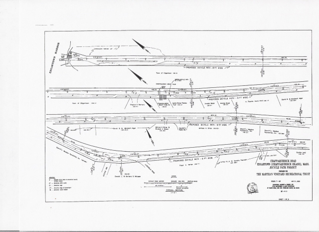
View the 1995 Survey of the Chappaquiddick Road as PDF files by clicking on the links below.
Videos: Surveys:
This page was last updated: September 20, 2010
All about a CHAPPY BIKE PATH
Take a ride down the Chappaquiddick Road! Part I
Chappaquiddick Road Part II
Scroll Down for more Videos!
Chappaquiddick Part III Dirt road to Wasque.
Herring Creek Road Bike Path to South Beach!
A Portion of the path back north via Katama Road.
Oak Bluffs County Road Bike Path
See 2009 Comments: CPC Letter to MV Times
Town votes reduced CPA appropriation of $6000 to survey Dike Bridge Road Only.
Opponents formed committee
"Sharing Chappy Roads"
Invited Public to Moderated Meeting August 11th, 2009 ..... 7:00 PM
View the 2009 Survey of the Dike Bridge Road as PDF files by clicking on the links below.
Proponents hire Northeastern University Engineering Students and Instructor Dan Dulaski to plan 2 way side path along the north side of Chappaquiddick Rd. The students make two presentations and Dulaski presents final plan July 10th, 2010 at Community Center.
Opinion Poll of Chappy landowners was taken, Some results were made available to the public.